2. Below the Sandstone Edge
Summary. Bus out from Frodsham to Helsby: walk back via base of hills to Frodsham. Walking distance approximately 4 miles, allow 2 hours walking time
Bus Out
Take bus 2 or X30, in a westerly direction, from Main Street (outside Trustee Savings Bank) – buses run approximately every half hour, but check timetable first!
Walk home
It is essential to check the bus timetable, and it’s a good idea to carry a map e.g. OS Explorer 267.
Summary. Bus out from Frodsham to Helsby: walk back via base of hills to Frodsham. Walking distance approximately 4 miles, allow 2 hours walking time
Bus Out
Take bus 2 or X30, in a westerly direction, from Main Street (outside Trustee Savings Bank) – buses run approximately every half hour, but check timetable first!
Walk home
- Alight from bus opposite park in Helsby, just before Robin Hood Lane. Walk in same direction as bus, turn left into Robin Hood Lane, rising gently uphill.
- On meeting Old Chester Road, cross straight over, continue on track uphill. (Ignore footpath sign on left).
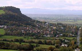
- At “Gorse Hill” bear right; at cross track, turn sharp left uphill. Go straight on & enter Helsby Quarry Local Nature Reserve.
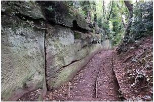
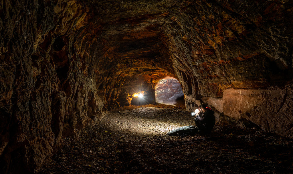
- Take either left through tunnel or right uphill, and continue on any path up through old quarry to car park.
- Turn left along road, ignoring Hill Road South. After road bears right & opposite “Ravenscar”, turn right on path into trees signposted, “Helsby Hill Middle Walk”.
- Continue straight along Middle Walk, ignoring all paths off. At crossroads of paths, with disused stile & several signposts, turn left where the right of way is indicated by just a yellow arrow.
- Descend along path, into snicket with fence on left, until a road is reached. Turn right & right again into Bates Lane.
- Continue straight past Landscape Dene; opposite “Berry Bank” & “No.80 Bates Lane”, take footpath on left signposted “Woodhouses & Frodsham”.
- Walk straight through an open field, (path clearly visible); at kissing gate, go straight on signposted “Woodhouse Hill”.
- Snicket passes between hedges. Descend a few steps & take bridge over small stream.
- Continue forward uphill along lane. Where Chestnut Lane meets a junction (Tarvin Road), turn left & immediately right opposite a postbox.
- At top of driveway, bear left through kissing gate into Woodhouse Hill Wood; take lower path signposted “Frodsham”.
- Weave along this path on edge of trees, eventually reaching sandstone wall on left, where steps rise quite steeply. Continue up steps (wall now on both sides), then down a couple of steps.
- Turn left, follow path by wall downhill. On passing “Dunsdale” on left, where track becomes a road, fork right: “Welcome to Frodsham Hill Wood”.
- After a rise, do not fork right, but continue straight along Bottom Walk. Soon after reaching a gravel surface, a road (Howey Lane) is reached.
- Turn right & immediately after a “sleeping policeman”, turn left before a cottage into snicket with sheep field on left.
- At T-junction of paths, turn left downhill, continue past two road ends straight down Park Lane. Cross over Princeway, then just before railway bridge, turn right into snicket alongside railway embankment.
- At T-junction, turn left under railway through back yard of Queens Head pub into Main Street beside Trustee Savings Bank.
It is essential to check the bus timetable, and it’s a good idea to carry a map e.g. OS Explorer 267.
| bowh2_sandstone_edge.docx |
